Architectural Surveys
Architectural surveys focus on older areas of the community to determine whether the components of that area have retained enough historic elements to be listed on the National Register of Historic Places. Surveys are conducted by a qualified professional, usually an architectural historian, who evaluates each feature based on seven criteria: location, setting, workmanship, feeling, association, materials, and design. The surveyor makes notes and takes pictures for each property. Most often the surveyor is observing buildings, but landscape, roadways and public art are also evaluated. Surveys can also be archaeological and, while this is relatively rare in Grand Forks, we had several in the years following the flood.
The survey process begins when the Commission identifies an area that appears to have potential for historic preservation or when a federally funded project, such as the flood protection project or a pipeline project, may impact historic resources. A surveyor is then hired with grant funding or with funds from the federal project. The completed survey is reviewed and approved by the Commission and by the State Historic Preservation Office. A general survey will show whether the area is likely to be eligible for listing on the National Register of Historic Places. If a federal project is the impetus for the survey, it will show whether that project has to provide special consideration for historic properties.
National Register listing of all of the Grand Forks historic districts began with surveys of each property within the potential borders of the district. Our most recent survey was for Midcentury housing in Grand Forks.

Archaeological Surveys
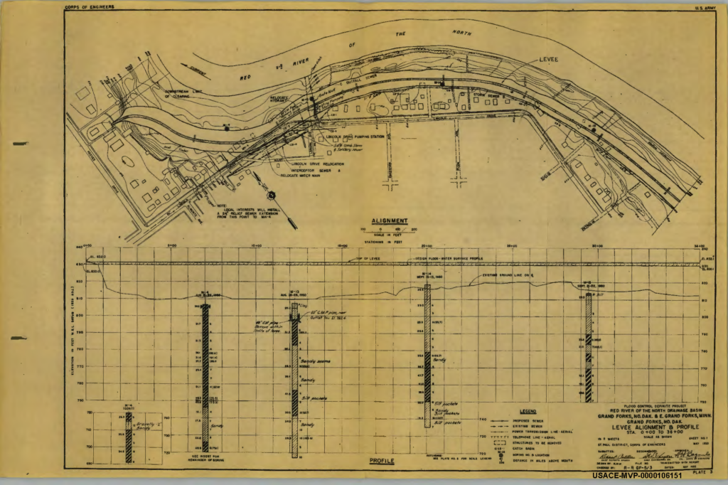
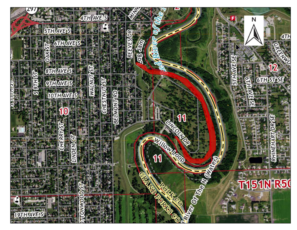
While conducted less frequently, the Grand Forks Historic Preservation Commission conducted an archaeological integrity survey in 2023, on the 1958 Floodwall built by the Army Corp of Engineers to protect the Lincoln Park neighborhood. The research question for the survey was to determine how much, if any, of the old floodwall still existed, and to consider how to mark the wall, or rather the absence of the wall.
You can read the full report here.
Below: 1950s line drawing plans by the Army Corp of Engineers.