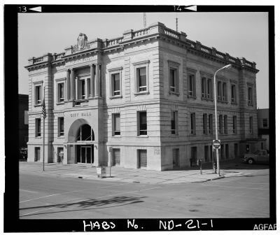
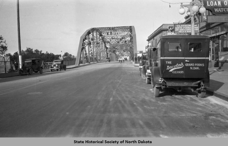
The Grand Forks Downtown Historic District is eligible for listing in the National Register of Historic Places for
its significant association with the earliest growth of the community’s public, commercial, social, and transportation related infrastructure. This growth is in turn directly related to federal Homestead legislation, the construction of transcontinental railroads, and the rapid settlement of the West that followed (criterion A). The district also represents the diffusion west and evolution of national architectural styles (criterion C). The period of significance extends from 1875, when the Grand Forks Original Township was first platted in anticipation of the arrival of the St. Paul, Pacific, and Manitoba railroad (later known as the Great Northern), until 1953, when construction of the Highway 8I/Washington St. corridor heralded the economic decline of the downtown district. Significant dates/events include 1875 and the platting of Grand Forks Original Townsite; 1880 and the arrival of the Manitoba; 1885 and the arrival of a branch line of the Northern Pacific; and 1997, when flood waters covered all of downtown, resulting in significant destruction, reconstruction, and recalculation of the viable eastern/riverfront limits to development.
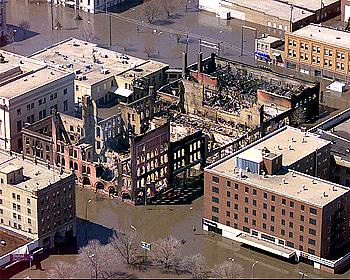
To much of the nation, the city of Grand Forks is best known for the flood of 1997 and the downtown fire that
followed. For long-time residents, however, the flood was simply the most dramatic and destructive of many. The Red River Valley is flat, flat, local resident Tom Berge says, like the bottom of a bathtub with a shallow scratch for a river down the middle; so flat that when the Red River rises each spring within the banks of that shallow scratch the slow moving waters have no where to go but out to the fields and communities that line its course. Topography is compounded by geographic rarity: to the extent that the slow-moving Red River flows, it flows north, with spring run off in the warmer southern reaches moving downstream towards the still-icy northern reaches, creating a build up of flood waters.
And both topography and geography are compounded by climate. It snows hard in eastern North Dakota and western Minnesota and some winters are worse than others. The Grand Forks Herald names local storms. The winter of 1996-1997, “Adam” came in before Thanksgiving and “Hannah” after Easter. These two storms and the six in between dropped a record 98.6 inches of snow, nearly 10 more than the previous record of 89.1 inches in 1897.6 In the flood that followed two weeks after Hannah, 90 % of Grand Forks was inundated, including the entire downtown district.
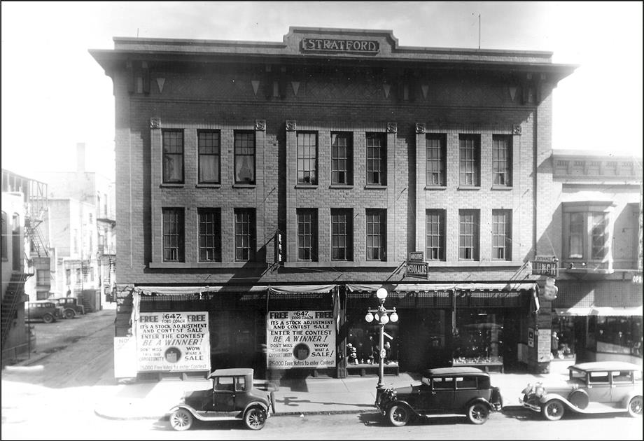
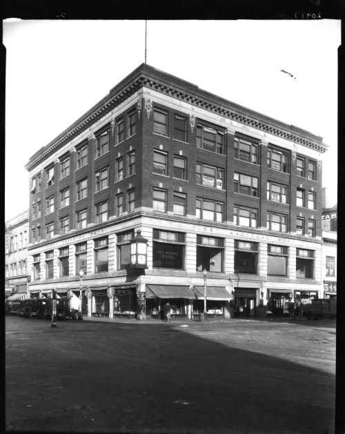
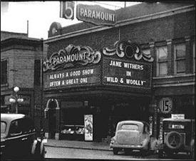
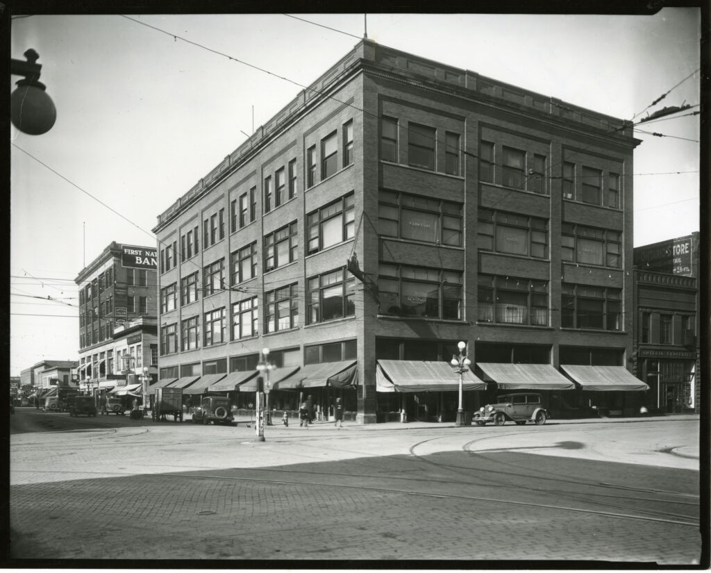
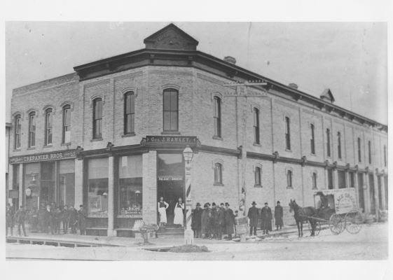
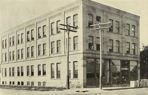
The Downtown Historic District includes nearly 70 structures and buildings dating from the 1880s into the 1960s. A few of the more prominent are featured here. In April 1997, a massive flood and concurrent fires heavily damaged the area. The fires destroyed nine major buildings and severely damaged many others. Flood water was four feet deep throughout the District.
Read the National Register nomination here.
For more information about historic downtown buildings, download our App (Historic GF) on Apple or Google Play, or request a print brochure.