From Neighborhood to City Retreat
The historic flood of 1997 impacted the entire city but marked the final chapter for Lincoln Park as a neighborhood filled with hundreds of single-family homes, an elementary school, and a home for the elderly. It was not the first time the neighborhood was inundated, but it was by far the most catastrophic. Despite a floodwall surrounding the neighborhood constructed in 1958, the unprecedented flood waters rose above the wall filling the neighborhood like a bowl. The wall held firm and eventually needed to be destroyed to release the water. Ultimately the low-lying neighborhood was deemed blighted. Sadly, the overwhelming destruction meant vacating the entire neighborhood. The residents who were displaced needed to find new homes, some leaving the city permanently. The new FEMA floodwall was designed to separate much of the low-lying areas along the river, including Lincoln Park, from the rest of the city.
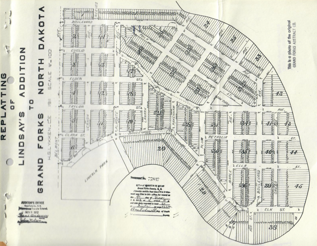
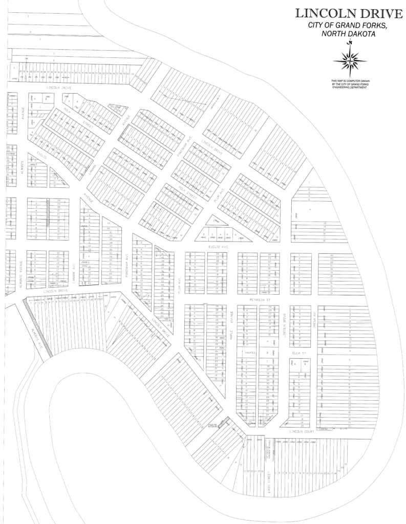
Pre-1997 Flood Neighborhood
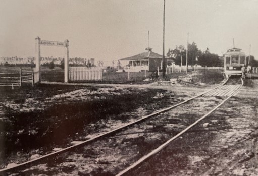
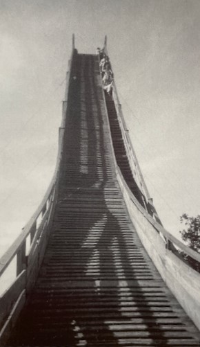
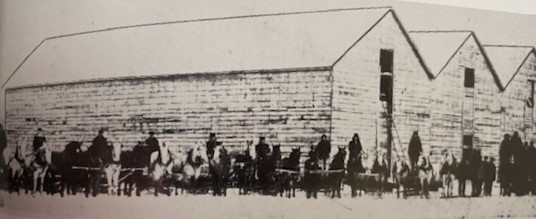
Early City directories show that homes were occupied along Euclid Avenue by the late 1880s. In the early decades, the street car brought people to Lincoln Drive for golfing and other recreation including a ski jump for winter fun. Ice harvested from the Red River was stored in warehouses located between Plum and Pakenham Avenues.
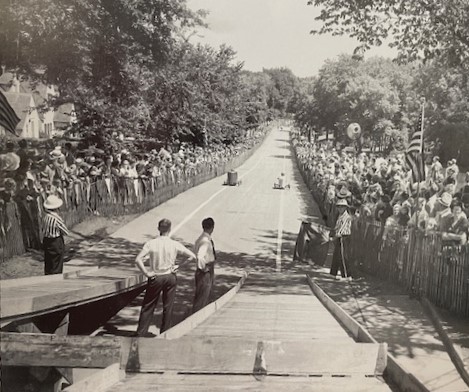
Despite numerous recorded floods over the century, the bustling neighborhood became home to hundreds of families. Children walked to the local Lincoln Park Elementary School (built in 1948), built go-karts to race in the annual Grand Forks Herald Soap Box Derby down the hill at 8th Ave, or raced cars around the river’s edge.
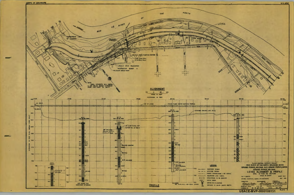
By 1958, persistent spring flooding led to the construction of a levee with the assistance of the Army Corp of Engineers. The levee held the waters back until the 1997 inundation despite the rallying of volunteers to raise the height with sandbags. The Grand Forks Historic Preservation Commission recently surveyed the old neighborhood to determine whether there were any remaining sections of the wall. That report can be found here.
Post Flood Transformation
As Grand Forks slowly recovered from it’s worst natural disaster, consideration was given to how best protect the city from future potential catastrophes. The devastation signaled the necessary removal of homes and the installation of a robust flood mitigation system at higher elevation. The current FEMA floodwall and earthen dike system has been tested since its completion but has held firm and kept the community safe from the rising river.
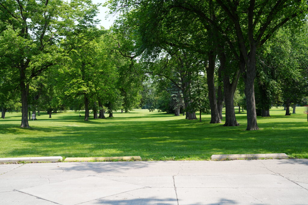
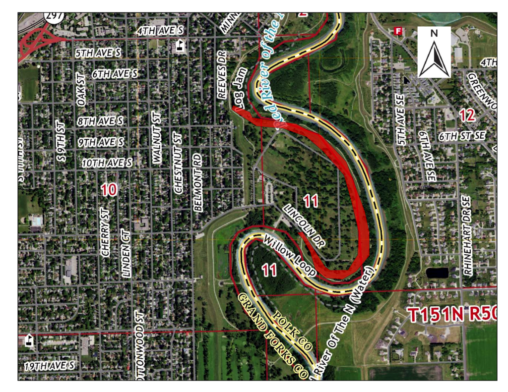
The land on the wet side has been transformed into an invaluable recreation corridor and an incredible asset for the cities of Grand Forks and East Grand Forks. The Greenway spans more than 2, 200 acres from the north to the south and is a playground for active locals and visitors.
Today, Lincoln Park is a magnificent space for walking, fishing, cycling and cross-country skiing and ice skating in the winter. Foxes, deer, beavers and birds call this park home. A playground and warming house, two fenced dog parks for off-leash fun, and a boat ramp providing easy access for river exploration. Picnic shelters, a volleyball net and frisbee golf course are frequently in use during the summer. Recent recreational additions to the park include horse shoe and bean bag toss games.
The ghostly remains of this once thriving residential neighborhood can be see in the organization of trees along forgotten boulevards and backyards, the depressions in the landscape where houses and garages once stood, and the occasional hint of driveways and street intersections. The land has been reclaimed by the river, at least in spring flood seasons, but quickly recovers for the enjoyment of all who enter the park.
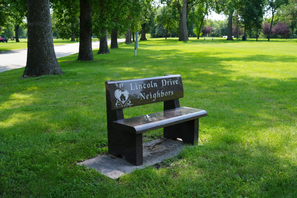
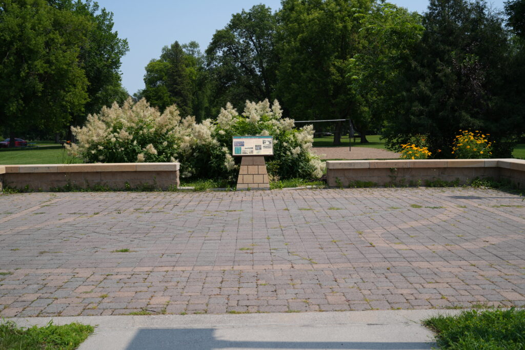
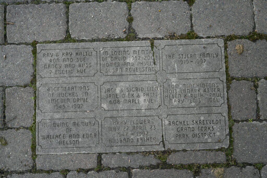
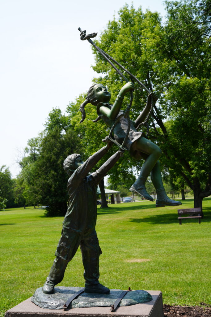
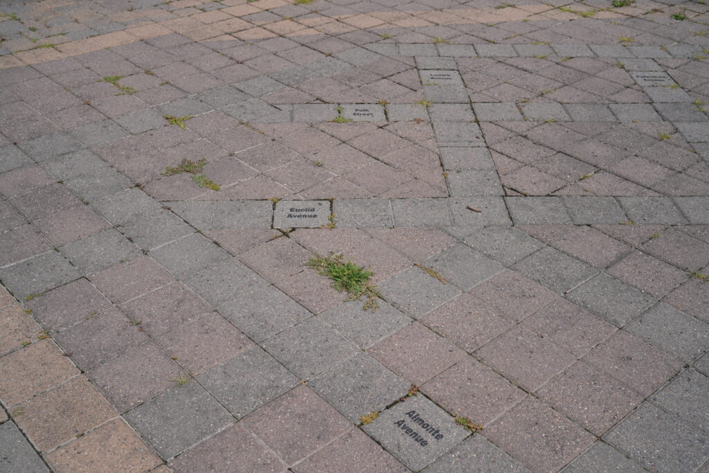
The City memorialized the neighborhood with a historic plaza, interpretive panel, and a paved reconstruction of the main streets. A bronze sculpture of children playing on a swing stands as a reminder of the Lincoln Park Elementary School. Granite benches and engraved plaques recognize those who lived in the neighborhood and whose lives were forever changed in April, 1997.
The next time you visit Lincoln Park, take a walk and explore this lost neighborhood. What do you see?